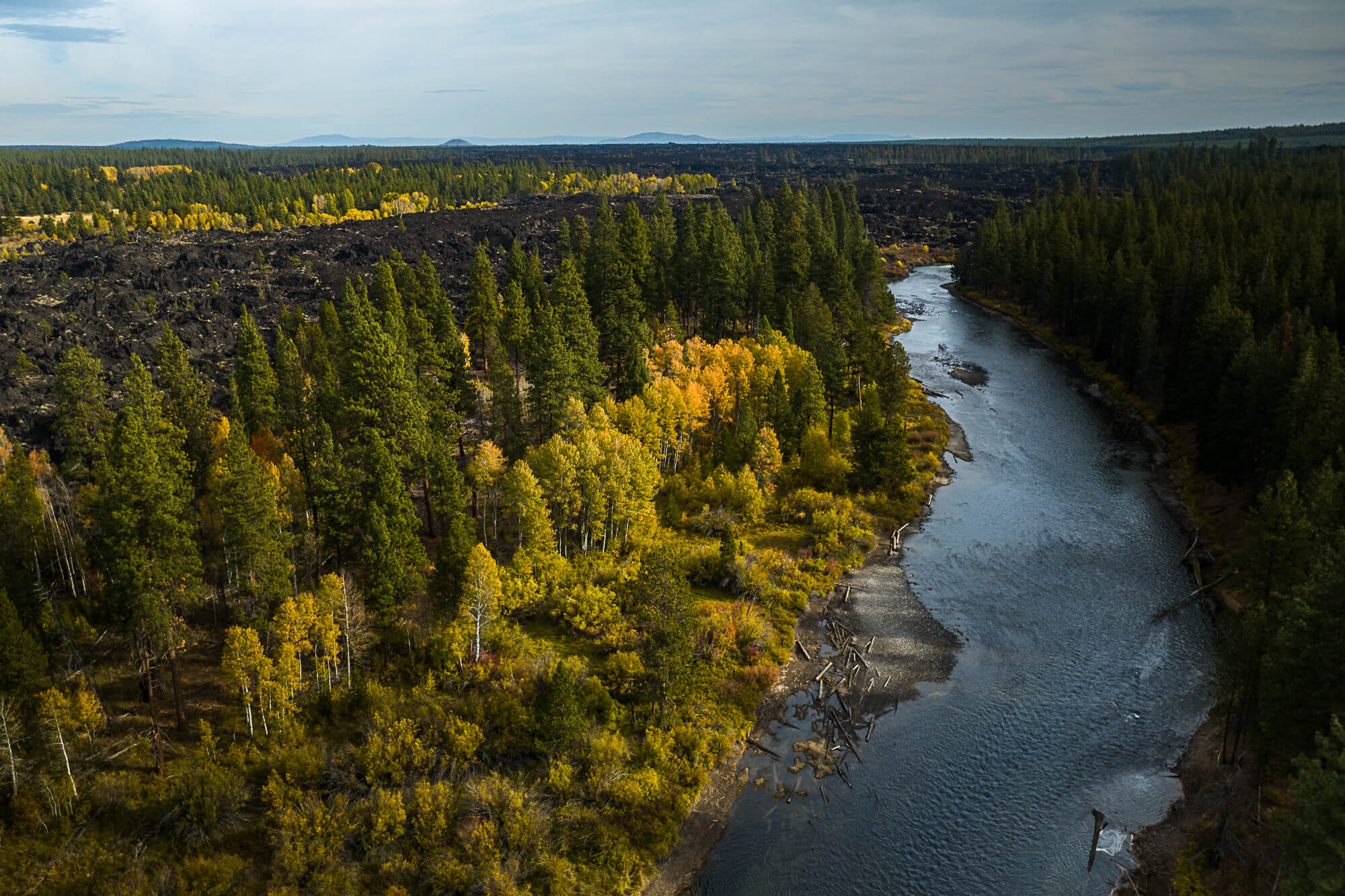
There’s something undeniably magical about hiking in Central Oregon every autumn. In the weeks after Labor Day, hikers enjoy cool temperatures, more solitude, bluebird skies, and dynamic fall foliage along hundreds of miles of trails throughout the region.
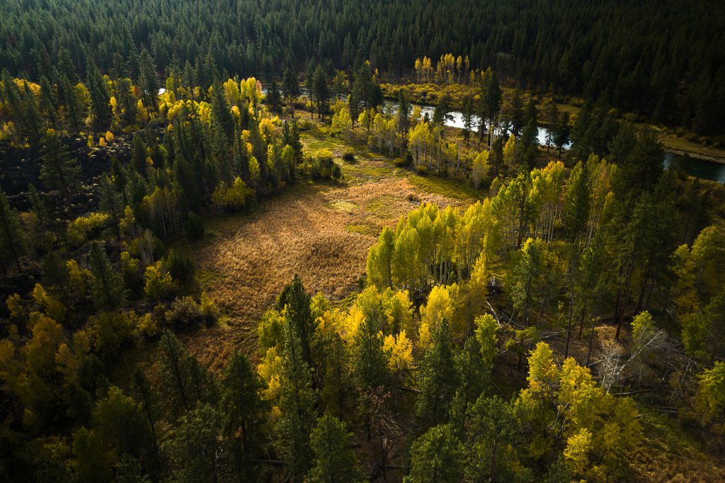
The first colors start popping in late September, especially in the mountains and in the Cascade foothills, and they blanket the entire region in vibrant displays throughout October and into early November. These are a few of the most colorful trails:
Chimney Rock Trail
- Distance (round-trip): 2.6 miles
- Elevation gain: 600 feet
- Duration: 1.5-2 hours
Just 17 miles south of Prineville and along the banks of the Crooked River, the Chimney Rock Trail brings together soaring views, fascinating geology, and occasional wildlife sightings. Best of all: A fall outing rewards hikers with comfortable (less dusty) trail conditions and plenty of solitude.
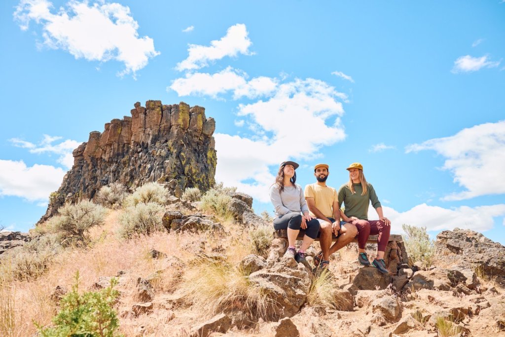
The Chimney Rock Trail affords views of lichen-covered cliffs, groves of gnarled juniper trees, and the winding Crooked River below. The turnaround point comes at the base of the appropriately named rock formation, which is partially made up of columnar basalt; from a bench at the wide-open viewpoint, take time to admire golden willow trees dotting the Crooked River Canyon—and keep an eye out for golden eagles, coyotes, and other species of wildlife.
No passes are required to hike the Chimney Rock Trail, and leashed dogs are permitted.
Tumalo Falls
- Distance (round-trip): Up to 8.2 miles
- Elevation gain: Up to 1,552 feet
- Duration: Up to 5 hours
You can enjoy most of what makes the Tumalo Falls Trail so special without ever actually hiking. But a longer outing into the surrounding forests, especially in fall, reveals the region’s natural beauty—including vibrant foliage and rushing waterfalls.
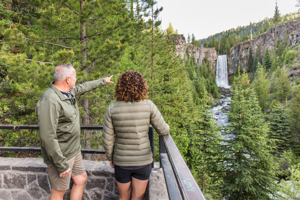
To reach the waterfall, begin in Bend and head west on NW Galveston Avenue, which becomes Skyliners Road and then Tumalo Falls Road, for about 14 miles. Soon after parking at the end of the road, you’ll arrive at the Tumalo Falls Day Use & Trailhead Viewpoint; here, the 97-foot-tall Tumalo Falls cascades in a leafy canyon of basalt, creating one of the most-photographed sites anywhere in Central Oregon.
The path continues behind the waterfall and ascends gently yet steadily while hugging the banks of Tumalo Creek. If you continue the hike, you’ll pass groves of quaking aspen turning bright yellow and a few more waterfalls—including Double Falls and Middle Tumalo Falls. You can turn around whenever you wish, which makes it easy to do an outing of anywhere from 2 to 8 or so miles. Learn about different hiking options at Tumalo Falls.
A federal recreation pass, such as a Northwest Forest Pass or America the Beautiful Pass, is required to park and hike at Tumalo Falls. Also note that dogs are not permitted on the trail.
Benham Falls Trail
- Distance (round-trip): 1.7 miles
- Elevation gain: 65 feet
- Duration: 1-1.5 hours
Between Bend and Sunriver, the Benham Falls Trail offers an easy-going, family-friendly escape that heads through a forest of ponderosa pine and along the banks of the Deschutes River.
Two trailheads offer access to Benham Falls; the 1.7-mile (round-trip) route mentioned here begins at the Benham Falls East Day Use & Trailhead. The mostly flat trail, where pups can go off-leash between mid-September and mid-May, heads north below a forest canopy that occasionally pops with red, yellow, and orange displays of foliage; those colorful scenes help cement the Benham Falls Trail as one of the best fall hikes in Central Oregon. A viewpoint then looks out over the 25-foot cascade in the heart of the Deschutes River. For a shorter outing, begin from the Benham Falls West Day Use & Trailhead—where a viewing platform, which overlooks the churning stretch of rapids, is a short walk from the parking area.
Wherever you begin, keep an eye out for migratory birds, foxes, deer, and other species of wildlife that live along the Deschutes River Trail. Dazzling foliage displays include quaking aspen trees with their famously golden leaves and vine maple whose leaves turn shades of deep red.
You’ll need a federal recreation pass, such as a Northwest Forest Pass or America the Beautiful Pass, to park and hike to Benham Falls. And while dogs are permitted on the trail year-round, they must be leashed between May 15 and September 15.
Looking for more inspiration? Check out our guide to easy hikes around Bend and Central Oregon.
Smith Rock State Park
- Distance (round-trip): Varies by trail
- Elevation gain: Varies by trail
- Duration: Varies by trail
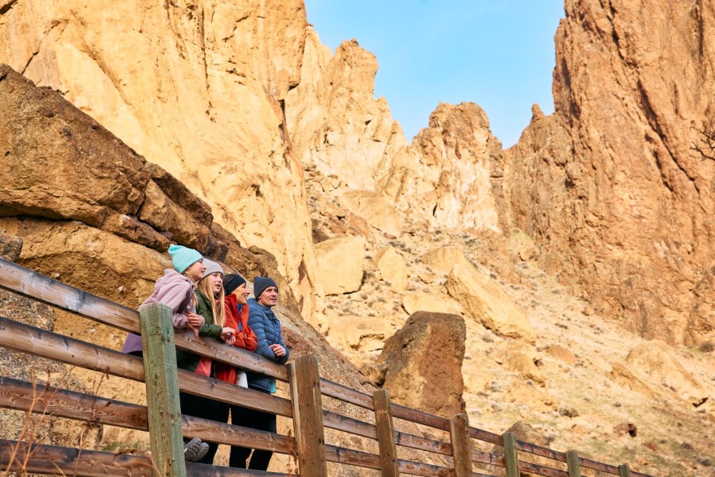
The namesake rock formations at Smith Rock State Park tower over the Crooked River, which snakes by at their base, opening up a wide variety of outdoor opportunities for adventurers from all walks of life.
A whole network of hiking trails crisscrosses the park, which sits just outside Redmond and Terrebonne—making it easy to plan an outing suited to your experience levels and time constraints. Cool autumn air, meanwhile, means fewer crowds and cements Smith Rock as one of the best fall hikes in Central Oregon.
Catch some of the park’s farthest-reaching views from atop the 2.6-mile (round-trip) Misery Ridge Trail; the hike scales the side of a sheer cliff but rewards hearty hikers with expansive views that extend west to the Cascade Range and across the high-desert landscape of Central Oregon. For an easier outing, enjoy a walk along the flat, family-friendly Crooked River Trail; the 4.3-mile (round-trip) hike follows the banks of its namesake waterway while showcasing occasional pops of fall color and affording views of rock climbers scaling the surrounding cliffs. Stay close to the riverside for golden cottonwood and reddish dogwood foliage displays, as well as multi-hued shrubs.
Note that an Oregon State Parks day-use parking permit is required for Smith Rock State Park. Permits are available at pay stations at the park, as well as from local vendors, and annual permits are available online. Leashed pets are welcome on the park’s trails, as well.
Deschutes River Trail
- Distance (round-trip): Varies by trail
- Elevation gain: Varies by trail
- Duration: Varies by trail
Chances are good you’ll wind up on the Deschutes River Trail at some point on your next visit—even if by accident.
That’s because two disconnected loops comprise nearly 30 miles of trail while passing through some of the region’s top sites and offering different glimpses at the beauty of Central Oregon.
The southernmost loop begins at the southern edge of Bend and heads toward Sunriver; this 17-mile loop affords views of Benham, Dillon, and Lava Falls in the Deschutes River; shows off old-growth pine forests; and is awash in foliage displays (courtesy of the aspen, vine maple, and willow trees that occasionally hug the path).
In all, eight trailheads offer access to the Deschutes River Trail around Sunriver, which is about 20 minutes south of Bend; visit the Deschutes River Trail website for a list of trailheads and to see which might work best for you. You’ll need a federal recreation pass, such as a Northwest Forest Pass or America the Beautiful Pass, to park and hike the southernmost stretch of the Deschutes River Trail. Dogs are permitted but must be leashed May 15-Sept. 15.
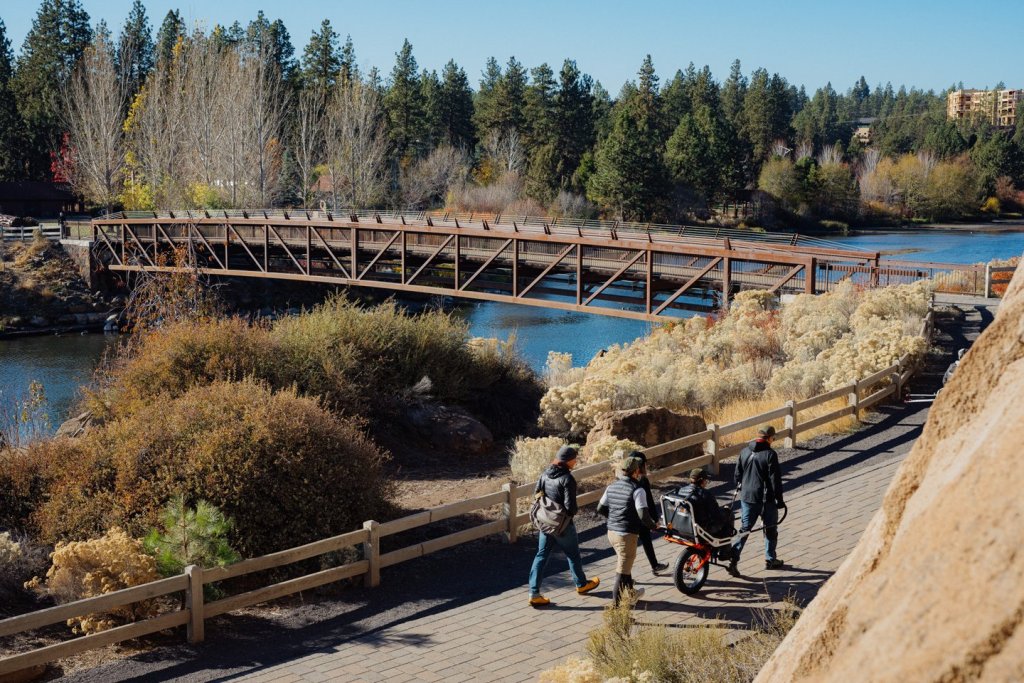
The northernmost loop measures 12 miles round-trip and is almost entirely within the city of Bend—but nevertheless shows off Cascade peaks, high-desert landscapes, and the Deschutes River canyon. Get started on the northernmost loop from the Old Mill Reach Trailhead, which takes hikers into ponderosa pine forests and around the Old Mill District and downtown Bend. Free parking is available in the Old Mill District, and no permits or passes are required. Dogs must be leashed on the trail; if you’d like to let Fido run free, the trail passes Riverbend Park, which hosts an off-leash dog area along the water.
If a 12- to 17-mile day sounds like more than you’d like to tackle, take heart: Both stretches of the Deschutes River Trail are mostly flat—and have plenty of trailheads and footbridges that make it easy to pick and choose the perfect length. Either way, you’ll be treated to some of the best fall hikes in Central Oregon.
Green Lakes Trail
- Distance (round-trip): 9.2-11.2 miles
- Elevation gain: 1,273-1,350 feet
- Duration: 4.5-6 hours
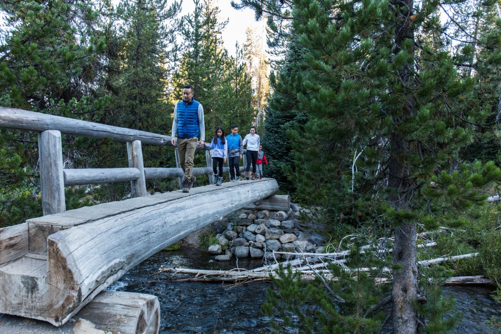
Residing along the Cascade Lakes Scenic Byway, the 11-mile (round-trip) Green Lakes Trail offers a bit of everything that makes Central Oregon such a beautiful place to hike. Best of all: It’s only about a 30-minute drive west of Bend via SW Century Drive and the Cascade Lakes Scenic Byway.
A few of the trail’s many highlights include an alpine forest, the thundering Falls Creek Falls, close-up views of a lava flow, the path’s namesake pools, and panoramic views of Broken Top, South Sister, and other iconic peaks. Keep an eye out for pika in the lava flows (their squeaks sound like a dog’s chew toy), and watch for deer relaxing in the meadows toward the end of the trail. Quaking aspen lights up the forest in electric golden hues by mid-October, as well.
The trail is a popular summertime destination, but crowds largely clear out by mid-October—and, as such, Green Lakes is one of the best fall hikes in Central Oregon. Be sure to snag a Central Cascades Wilderness Permit if hiking before Oct. 15, and make sure you have a federal recreation pass whenever you hit the trail. Dogs are permitted whenever the trail is open, but they must be leashed between July 15 and Sept. 15.
Shevlin Park
- Distance (round-trip): 4.6 miles
- Elevation gain: 190 feet
- Duration: 2.5 hours
At the northwestern edge of Bend, Shevlin Park surrounds Tumalo Creek and hosts several miles of hiking trails that traverse ponderosa pine forests and high-desert terrain.
That makes Shevlin Park a popular park all year long, but it comes alive in fall when the leaves on quaking aspen trees turn whole stretches of trail into veritable tunnels of gold. See it all from along the Shevlin Park Loop, which circles the park and offers up-close introductions to its many highlights. This is also one of the few places in the high desert where you’ll find Western larch trees, whose needles turn gold in early and mid-October.
There is no fee to park or hike at Shevlin Falls. Dogs are welcome on the park’s trails but must be leashed at all times to protect and respect the park’s wildlife.

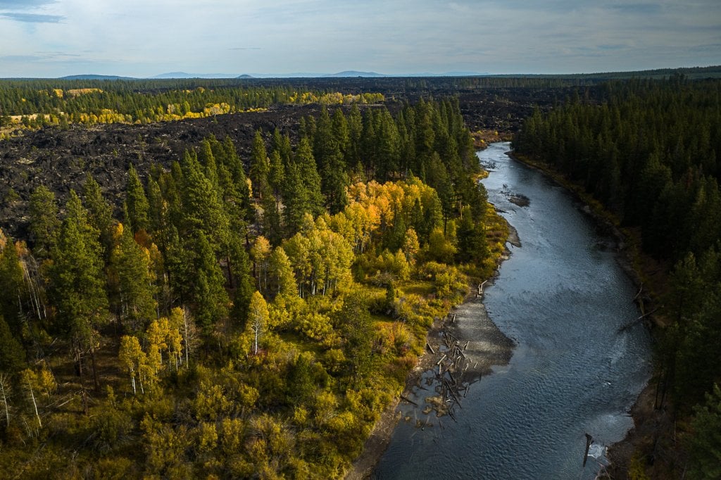
Chase Those Colors!
Ready to enjoy fall hikes near Bend, Oregon? Start planning with these helpful tips:
Where to hike: We’ve included seven of our favorite hikes here—but if you’re looking for a new challenge, check out other trails in the region. Ideas include paths that pass lava flows, rock formations, waterfalls, and more.
Daylight: The changing season brings shorter hours of daylight; on October 31, for instance, the sun rises at 7:40 a.m. in Bend—and sets just before 6 p.m. If you’re planning an early-morning or late-afternoon stroll, check that day’s sunrise and sunset times, and plan accordingly so you’re not caught in unsafe conditions.
Weather: Weather in the high desert is generally pleasant throughout fall—but can change frequently. Prepare for possibly chilly mornings, occasional winds, and the rare rain shower by dressing in layers and packing the Ten Essentials.