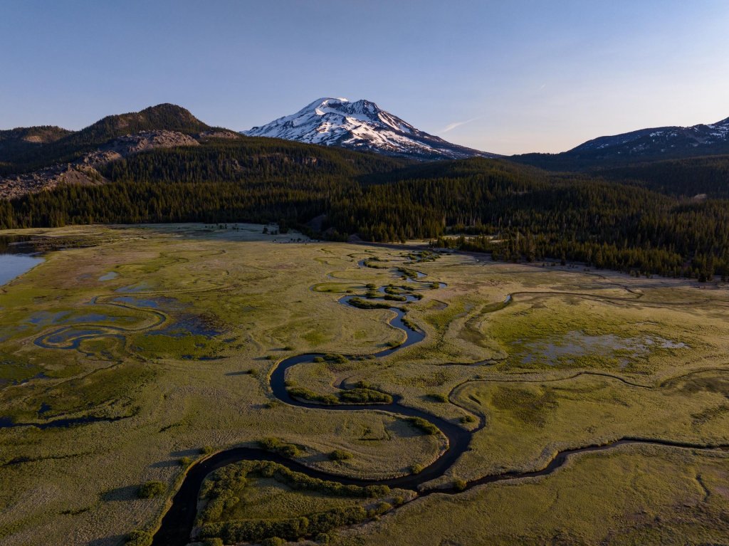
From leisurely walks by the river to demanding full-day hikes, there’s a Central Oregon Hiking Trail for every adventurer. Those trails include:
Table of Contents
Here are some of the best hiking trails in Central Oregon:
Pilot Butte State Park
Nearest city: Bend
Distance (round-trip): 1.8 miles
Elevation gain: 450 feet
The heart of Pilot Butte State Scenic Viewpoint, which sits just east of downtown Bend and within city limits, is Pilot Butte—an extinct cinder cone. From a parking area at its base, a 1.8-mile (round-trip) hike circles the butte while gaining about 450 feet on a dirt path. After passing through occasional stands of ponderosa pine, hikers arrive at a wide-open summit—where 360-degree views include the expansive high desert, the mountains of Central Oregon, and the surrounding city of Bend. This is one of the most popular places in Bend to enjoy the sunset as it falls behind more than a dozen Cascade peaks to the west.
Note that a road circles the butte and is open to vehicle traffic between mid-April and late October or early November; in winter, the road offers a comfortable alternative to the aforementioned hiking trail. Restrooms are available at the trailhead and at the summit.

Sunset from the summit of Pilot Butte in Bend, Oregon

Hiking in Shevlin Park near Bend, Oregon
Shevlin Park – Loop Trail
Nearest city: Bend
Distance (round-trip): 5 miles
Elevation gain: 250 feet
Shevlin Park sits just three miles from downtown Bend—and is a year-round hangout for locals and visitors alike. The well-signed, five-mile (round-trip) Shevlin Loop Trail heads into the heart of the park while largely following Tumalo Creek below. It gains about 250 feet of elevation, most of which comes soon after crossing the creek on a footbridge; along the way, hikers head through a forest of ponderosa pine, a rugged canyon, and a stand of trees recovering from a 2015 wildfire.
Deschutes River Trail
Nearest city: Bend
Distance (round-trip): 3 miles
Elevation gain: 125 feet
You could spend entire days hiking the Deschutes River Trail, which largely runs between Bend and Sunriver while following its namesake waterway. We’d suggest starting with a section of Deschutes River Trail that begins (and ends) in the Old Mill District. This hike measures roughly three miles round-trip while boasting negligible elevation gain. It begins in the heart of the Old Mill District before heading south on a paved trail that affords Cascade peak views and never strays far from the river; in less than a mile, it reaches Farewell Bend Park; hikers short on time can cross a bridge and head back on the other side of the river here—cutting roughly two miles off the total distance. Those who keep going soon leave the paved path behind for a riverside forest of ponderosa pine. Hikers eventually cross the river at what’s called South Canyon Reach and follow an occasionally shaded trail back to the Old Mill District. (Those who keep heading south along the Deschutes River Trail may walk alongside Dillon Falls and even catch rafters navigating whitewater at Big Eddy—a series of tumultuous rapids in the river.)

Hiking the Deschutes River Trail near Bend, Oregon

Benham Falls viewpoint near Bend and Sunriver, Oregon
Benham Falls
Nearest city: Bend/Sunriver
Distance (round-trip): 0.2-1.5 miles
Elevation gain: 50 feet
Five miles north of Sunriver, this hiking trail provides a spectacular scene of untamed rapids. Hikers have two mostly flat options for reaching Benham Falls. The first option comes via the Benham Falls East Day Use Area/Trailhead; from here, it’s a 1.5-mile round-trip trek through forests of ponderosa pine. Hikers can also start from the Benham Falls West Day Use Area/Trailhead—just a 0.2-mile round-trip hike from the falls; not far from the west trailhead, an overlook peers upstream and offers an impressive view of the thundering rapids.
Note that hikers must pay a $5 day-use fee (a Northwest Forest Pass or America the Beautiful Pass is also acceptable). Also: Dogs must be leashed at all times at either trailhead—and along the trail between May 15 and September 15.
Lava Cast Forest
Nearest city: Bend/Sunriver
Distance (round-trip): 1 mile
Elevation gain: 80 feet
The Lava Cast Forest Trail, part of the Newberry National Volcanic Monument, heads through an otherworldly forest on the north side of Newberry Caldera. The one-mile (round-trip) paved trail gains about 80 feet while passing through a rugged lava flow. Several thousand years ago, a lava flow overtook an old-growth forest on this site—eventually destroying the trees as it cooled and leaving behind circular “casts” where they once stood. The trail is typically open between May and late October or early November—depending on when the season’s first snowfall arrives.
Note that hikers must pay a $5 day-use fee (a Northwest Forest Pass or America the Beautiful Pass is also acceptable).

A twisted Juniper tree in the Lava Cast Forest near Bend and Sunriver, Oregon Photo by @danpricephoto

Inside the Lava River Cave, Newberry National Volcanic Monument
Lava River Cave
Nearest city: Bend/Sunriver/La Pine
Distance (round-trip): 2.2 miles
Elevation gain: 150 feet
Thirteen miles south of Bend on Highway 97, on the east side of the road, is Lava River Cave—the largest un-collapsed lava tube in the state. A 2.2-mile (round-trip) trail descends into the cave, where hikers can head into the heart of the rocky lava flow in total darkness—other than whatever lantern or flashlight you bring into the cave. The sandy path and minimal elevation gain makes this an easy hike.
To help curb the spread of White-nose Syndrome (which is fatal to bats), hikers should not wear any clothing or gear that has been in other caves or mines. Close-toed shoes are advised for safety, as are warm clothes—since the cave is only about 42ºF year-round. Hikers are encouraged to bring two light sources; rentals are available for $5 at the interpretive site. The cave is open to the public between early May and mid-September. Be sure to pack out whatever you pack in—including snacks and wrappers—to preserve the cave’s ecosystem and protect its inhabitants.
A $5 day-use fee (such as Northwest Forest Pass or America the Beautiful Pass) is required, as are timed reservation tickets—available on a one-month rolling basis in spring and summer via Recreation.gov.
Big Obsidian Flow
Nearest city: La Pine
Distance (round-trip): 0.75 miles
Elevation gain: 200 feet
The Big Obsidian Flow is just 1,300 years old—making it the youngest lava flow in Oregon. Sitting inside Newberry Caldera, a 0.75-mile (round-trip) interpretive trail heads into the heart of the flow, where glassy obsidian sits alongside more muted, but no less dramatic, pumice rocks. A few interpretive panels explain how it all happened and detail the natural history of Newberry Volcano. The trail is typically accessible between June and late October or early November.
Note that hikers must pay a $5 day-use fee (a Northwest Forest Pass or America the Beautiful Pass is also acceptable).

Hikers in Newberry National Volcanic Monument’s Big Obsidian Flow

Viewpoint at Paulina Falls near La Pine, Oregon
Paulina Falls Trail
Nearest city: La Pine
Distance (round-trip): 0.5 miles
Elevation gain: 125 feet
The Paulina Falls Trail sits within the Newberry National Volcanic Monument—and while the monument is most closely associated with its volcanic features, this trail affords some of Central Oregon’s best waterfall views. It begins at the Paulina Falls Day Use Area, where you can watch the double falls tumble 80 feet over a volcanic rock shelf and into Paulina Creek below. A 0.5-mile (round-trip) trail loses about 125 feet as it descends to the base of the falls—where up-close views await. The trail is typically accessible June-October, depending on snowfall.
Note that hikers must pay a $5 day-use fee (a Northwest Forest Pass or America the Beautiful Pass is also acceptable).
Tumalo Falls
Nearest city: Bend
Distance (round-trip): 7 miles
Elevation gain: 1,450 feet
Several miles of trails splay out across the woods around Tumalo Falls—but the 7-mile (round-trip) Tumalo Falls Loop Hike rewards hikers with views of several waterfalls. The hike begins near the Tumalo Falls Day-Use Area, where spectacular views of the 97-foot-tall Tumalo Falls await; from there, it ascends up to 1,450 feet while following various stems of Tumalo Creek. Views along the way include several unnamed waterfalls and Middle Fork Tumalo Falls. The road to Tumalo Falls is open June-October; on sunny weekends, try to hit the trail before 9 a.m. for plenty of solitude.
Note that hikers must pay a $5 day-use fee (a Northwest Forest Pass or America the Beautiful Pass is also acceptable).

Tumalo Falls near Bend, Oregon

Green Lakes Trail near Bend, Oregon
Green Lakes Trail
Nearest city: Bend
Distance (round-trip): 9-11 miles
Elevation gain: 1,275-1,350 feet
The Green Lakes Trail is among the most popular hikes in Central Oregon—offering a steady diet of impressive views. Hikers may gain up to 1,350 feet of elevation, though most of that ascent is gentle and well-graded. Highlights include the thundering Falls Creek Falls, a short stretch of trail that parallels a rocky lava flow, views of Broken Top from the first of the three Green Lakes, and an up-close look at South Sister—which seems to rise directly from the shores of the lakes. The hike is nine miles (round-trip) to the first of the three Green Lakes—and about 11 miles (round-trip) if you’d like to see the rest. Learn more about the Green Lakes Trail, which departs from the Green Lakes/Soda Creek Trailhead.
Note that hikers must pay a $5 day-use fee (a Northwest Forest Pass or America the Beautiful Pass is also acceptable) and, between mid-June and mid-October, hikers must obtain a Central Cascades Wilderness Permit. Day-use permits are released on two rolling windows—10 days out and two days out—and cost $1 via Recreation.gov. The trail sits along the Cascade Lakes Scenic Byway, typically open between late May and early November; snow may linger on the trail well into early July, so exercise caution if hiking in early summer.
Todd Lake Trail
Nearest city: Bend
Distance (round-trip): 1.7 miles
Elevation gain: 75 feet
Todd Lake is one of the first areas that drivers pass when taking the Cascade Lakes Scenic Byway southeast out of Bend—making it a popular stop for picnickers, day hikers, and overnight campers alike. A 1.7-mile (round-trip) trail gains about 75 feet while circling the lake—and offering spectacular views of Broken Top and Mount Bachelor. Visit in winter via one of the top snowshoeing trails near Bend, Oregon.
Note that hikers must pay a $5 day-use fee (a Northwest Forest Pass or America the Beautiful Pass is also acceptable). The trail sits along the Cascade Lakes Scenic Byway, typically open between late May and early November; snow may linger on the trail well into June, so exercise caution if hiking in early summer.

Todd Lake Trail near Bend, Oregon

View of Sparks Lake from along the Ray Atkeson Memorial Trail near Bend, Oregon
Ray Atkeson Memorial Trail
Nearest city: Bend
Distance (round-trip): 2.5 miles
Elevation gain: 100 feet
The 2.5-mile (round-trip) Ray Atkeson Memorial Trail at Sparks Lake gains about 100 feet while showcasing a bit of everything that makes Central Oregon so special: South Sister rises over the lakeshore to the north, lava flows line portions of the trail, and quiet forests of lodgepole pine offer a sense of solitude.
Note that hikers must pay a $5 day-use fee (a Northwest Forest Pass or America the Beautiful Pass is also acceptable). The trail sits along the Cascade Lakes Scenic Byway, typically open between late May and early November; snow may linger on the trail well into June, so exercise caution if hiking in early summer. Low-clearance vehicles should drive slowly on the forest road to the trailhead.
Oregon Badlands Wilderness Area
Nearest city: Bend
Distance (round-trip): 6.5 miles
Elevation gain: 175-235 feet
Just 20 minutes east of Bend, the 29,000-acre Oregon Badlands Wilderness Area sits atop the Badlands Volcano and is today home to several species of wildlife and a wide range of fascinating natural features. Roughly 50 miles of trails crisscross the Badlands, but we’d suggest the Flatiron Rock Trail, which gains about 220 feet while traversing 6.5 miles (round-trip). The wide, gently graded path passes countless knee-high sagebrush bushes and old-growth juniper trees—some of which date back nearly 1,000 years. The turnaround point is Flatiron Rock, a fortress-like outcrop that rises some 50 feet above the surrounding landscape and affords views of Mount Jefferson and other Cascade peaks to the west.
Note: The badlands offer little shade, so avoid a midday hike in summer, wear sunscreen, and bring plenty of wate

Trail markers in the Oregon Badlands Wilderness near Bend, OregonPhoto by @crookedriverranchcabins

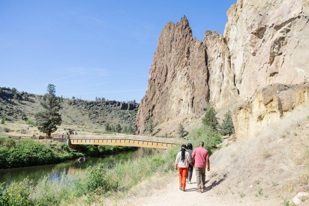
Hiking at Smith Rock State Park near Redmond, Oregon
Smith Rock State Park – Misery Ridge-River Trail Loop
Nearest city: Redmond and Terrebonne
Distance (round-trip): 4.2 miles
Elevation gain: 880 feet
Several miles of trails crisscross Smith Rock State Park—one of Oregon’s most popular state parks. Enjoy a glimpse of the park’s highlights along the Misery Ridge-River Trail Loop, which totals 4.2 miles (round-trip) and gains about 880 feet; the path ascends the steep, rugged Misery Ridge, offers views of the surrounding farmland and high-desert landscapes, shows off the iconic Monkey Face rock formation, and parallels the Crooked River in a rocky canyon. The trailhead is just 15 minutes northeast of Redmond—so relax with a cold beer or cider in Redmond after your day on the trail.
Note that there is a $5 day-use fee at Smith Rock State Park, which can be paid at kiosks in each parking area. The park can also fill to capacity on sunny spring and summer weekends, so consider a midweek hike—or starting your hike before 9 a.m. on Saturdays and Sundays—to enjoy a bit more solitude.
Suttle Lake Trail
Nearest city: Sisters
Distance (round-trip): 3.2 miles
Elevation gain: 75 feet
Suttle Lake sits about 15 minutes northwest of Sisters and 10 minutes from Black Butte Ranch—and its day-use area provides the perfect jumping-off point for the 3.2-mile (round-trip) Suttle Lake Loop Trail. The mostly flat trail largely follows the banks of Suttle Lake while darting between patches of forest, day-use areas, and campgrounds; views include the lake and Mount Washington towering over the horizon. The lake is extremely popular in summer—try to start hiking by 9 a.m. on summer weekends to enjoy a quiet experience—but outings in early to mid-October reward hikers with dramatic fall foliage displays.
Note that hikers must pay a $5 day-use fee (a Northwest Forest Pass or America the Beautiful Pass is also acceptable).
Group Hiking at Suttle Lake near Sisters, Oregon

Black Butte near Sisters, Oregon
Black Butte Trail
Nearest city: Sisters
Distance (round-trip): 4.8 miles
Elevation gain: 1,560 feet
Just 30 minutes northwest of Sisters is the Black Butte Trail—one of the most iconic hiking paths in all of Central Oregon. The 4.8-mile (round-trip) hike gains about 1,560 feet while passing through a forest of ponderosa pine and wide-open meadows that offer colorful wildflower blooms in late spring and early summer. At the symmetrical butte’s pancake-flat summit, hikers can walk by an abandoned cupola and enjoy views of nearby Cascade peaks. The trail is typically open June-October; if hiking in summer, consider starting before 9 a.m. to beat the heat—since little of the trail is shaded.
Note that hikers must pay a $5 day-use fee (a Northwest Forest Pass or America the Beautiful Pass is also acceptable).
West Metolius River Trail
Nearest city: Sisters and Camp Sherman
Distance (round-trip): 5.7 miles
Elevation gain: 270 feet
The 5.7-mile (round-trip) West Metolius River Trail departs from the Lower Canyon Creek Campground and rarely strays far from the riverbank. Along the way, hikers enjoy views of the crystal-clear river, colorful wildflower blooms in mid-spring, and verdant islands (which provide habitat for local bird populations). The idyllic turnaround point is Wizard Falls Hatchery, which rears six species of trout and salmon that can be viewed in open-air pools; a few gumball machines dispense fish food, if you or your little ones would like to feed the fish. If you’re looking for post-hike refreshments, learn more about the breweries and cideries in Sisters.

A view of the winding Metolius River near Sisters, Oregon Photo by @sistersvacationrentals

Lava flows surrounding the Dee Wright Observatory near Sisters, Oregon
Dee Wright Observatory – Lava River Interpretive Trail
Nearest city: Sisters
Distance (round-trip): 0.5 miles
Elevation gain: 30 feet
The stone Dee Wright Observatory, constructed from lava rock in 1935, sits just 15 miles west of Sisters at the crest of Highway 242—also known as McKenzie Highway. When the highway is open and passable, typically between mid-June and early November, visitors can walk a short set of steps to the top of the observatory—where 360-degree views of sprawling lava flows and roughly a dozen Cascade peaks await. At the base of the observatory, enjoy a mostly flat, 0.5-mile (round-trip) hike on the Lava River Interpretive Trail; the paved path loops through the jagged lava flows and hosts interpretive panels that detail the region’s natural history.
For Additional Information Contact:
Central Oregon Welcome Center 541-389-8799Lava Lands Visitor Center 541-593-2421Bend-Ft. Rock Ranger District 541-383-4000Sisters Ranger District 541-549-7700Oregon State Parks 541-388-6055Bend Parks & Recreation 541-389-7275Fishing License, Fish & Wildlife 541-388-6363Road Conditions, ODOT 800-977-6368Emergency: 911